Maybe I should just make peace with being that map guy who keeps excitedly posting about new map doodles that I’ll mostly never be using for any campaigns?
I was, once again, feeling unhappy with the latest maps for Kaendor that I made over the last week since the coast lines look too square and there’s too many big blank areas that are just forest with no further detail. So I went looking again for very large maps of the natural geography of the Earth to see if I find any regions with an interesting topography that I could use as references. And I realized that a map of the world looks really weird and barely recognizable when you simply mirror it.
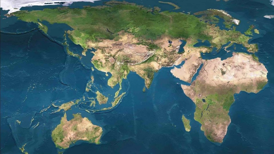 I really like that look (even with the heavy stretching at the poles) and think that this would make a great global map for Kaendor. Zooming in on East (now West) Asia, I noticed that the overall layout of the coastlines already has a very similar general arrangement and my various sketches for Kaendor maps have had for the last two years or so now.
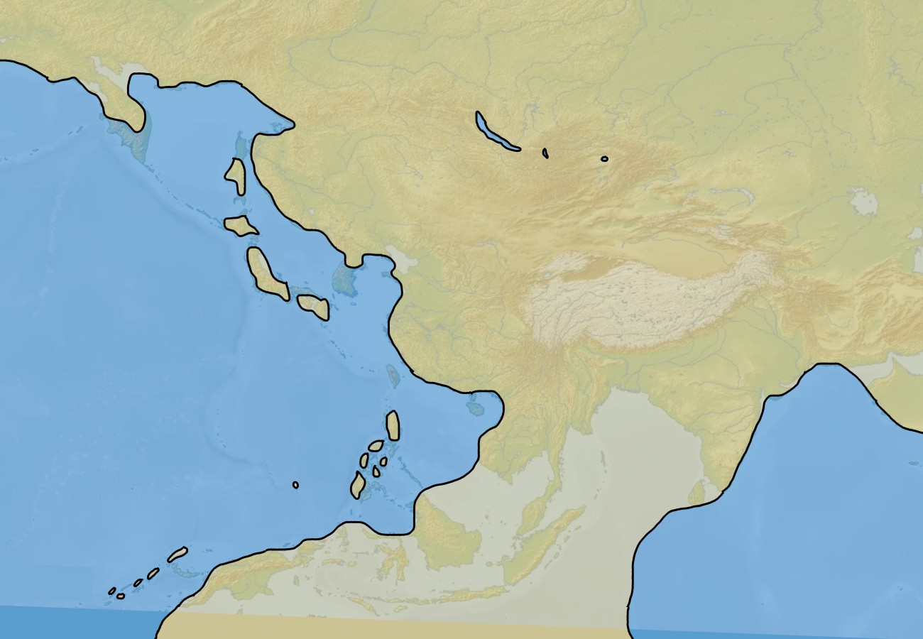 Southeast Asia happens to be where I always placed the huge jungles of Kemesh where the remnants of the ancient naga empires are barely holding on. But making all the small seas between the Indonesian island into dry land (which was once the case), there’s now just precisely the vast jungles that I wanted in that place. The cool thing about this is that I can still use all the mountain ranges in that region as a fast method to have a perfectly plausible topography.
I also decided to greatly simplify the islands of the First Island Chain because I think those would stand out too obviously as being just a mirrored map of Asia. And it also will save me a lot of work with very fiddly details.
A map at the scale above is way too big for any practical uses in any single campaign, and even covering that area on a 30-mile hex map would be ridiculously huge. As a map for Kaendor, I already changed the scale to 75% the lengths of distances (which means 56% the total area), just so that I can fit more interesting squiggly coastlines on the cool A2, 30-mile hex sheets I made. For the Kaendor ’24 campaign, I instead want to focus just on the central area shown below. But having that large, zoomed out map with little detail at hand as a reference will surely come super handy when it comes to adding mentions about distant lands and peoples beyond the known world to the setting. And if at some point in the future I might want to fully map out some of those areas in the same higher detail, it will all already be geographically consistent with whatever mentions and references I had used before.
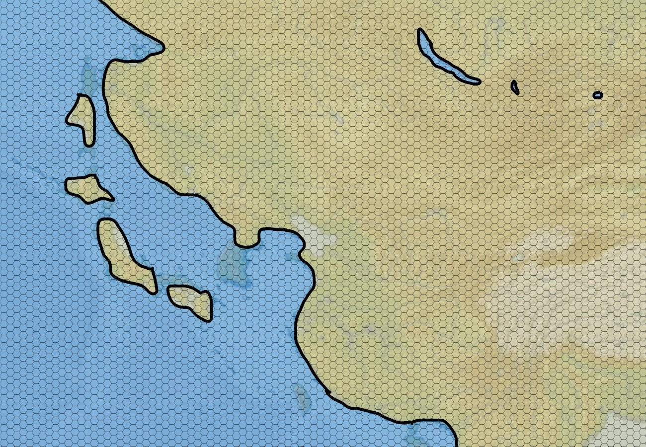 And this is the area that I plan to turn into a fully worked out 30-mile hex map. Having all the mountain ranges and rivers already in place, and being able to look up images of the real landscapes, really helps a lot with inspiring ideas to what details I could fill this map with. I even can look up climate data if I want to, though with the map now flipped, wind directions and the corresponding rain patterns would not match up perfectly. But I think the climate of Europa and East Asia happens to be similar enough that it doesn’t even bother this one geography mega-nerd who surely is the only person to pay a single thought to this.
I’m having a lot of fun with this, and I am feeling really good (though I always do that) about this maybe being the final geography layout for Kaendor. With the arrangement being so similar to what I already established about the geography in the past, it should be really easy to copy all the locations over on this map without much breaking.