Every model builder should know what kitbashing is. Why isn’t mapbashing an established technical term among map makers?
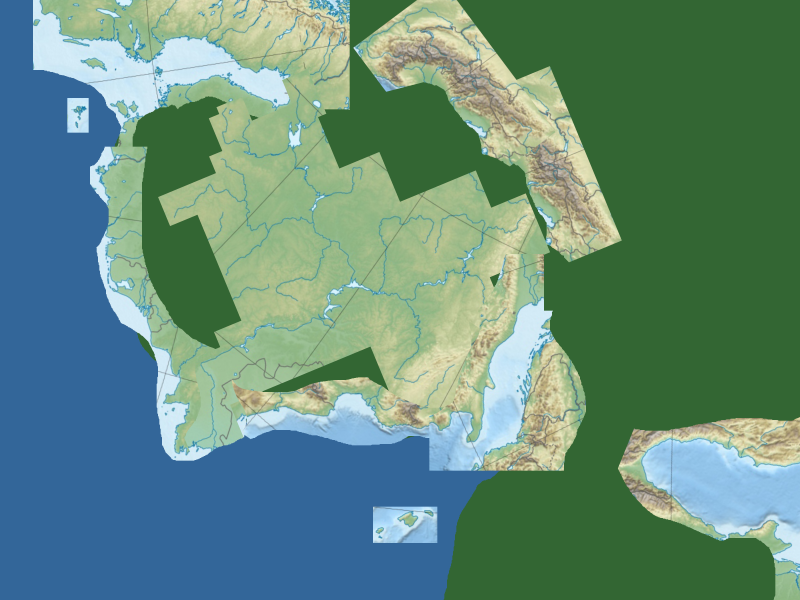 While I was working on a new map layout for Kaendor that better reflects some design changes I’ve decided on, I was comparing notes with other mappers and noticed that on my scale reference Europe map, that the Adriatic Sea had almost the exact dimensions as the narrow sea in the middle of my sketch, and Italy was a close match to the mountain range I want to put to the West of it, if you just rotate it a little bit. On a map of Europe, there’s something very close to any geographic shape I had in mind, and so I just kept cutting out more pieces from my reference map and cutting and rotating them until it looked like this. I didn’t even use scaling and mirroring, with is additional options you can use for something like this.
 And two hours later, I had something looking like this. I really like this.
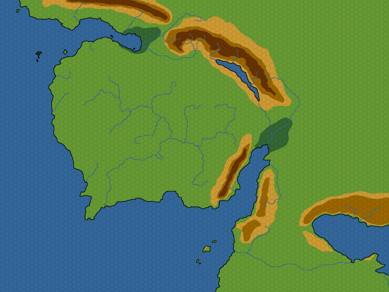
Like with my hugely popular technique to make hex maps, I’ve been using GIMP for this. Though I am certain PhotoShop has all the features for doing this as well.
There’s no better way to get more realistic looking shorelines, river systems, and islands than tracing actual shorelines, river systems, and islands. And by using topographical maps like I did with this map, you also get some information about what kinds of mountain formations further inland contributed to creating these shapes.
Aus reinem Zufall habe ich fast das gleiche vor einem Monat gemacht, ich habe aber Stücke aus meinen beliebtesten Fantasywelten genommen und zusammengeschnürt. Ich habe ihre ursprüngliche Skala beibehalten – wenn es eine Skala gab – mit Ausnahme von Hyborien (die Binnensee), das wirklich zu riesengross war.
Seite 2 des Pdfs : http://sambahsa.pbworks.com/w/file/148869636/bogaturia.pdf
Man sieht, dass Nordwestmittelerde und Aventurien sehr klein sind….