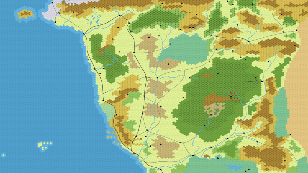
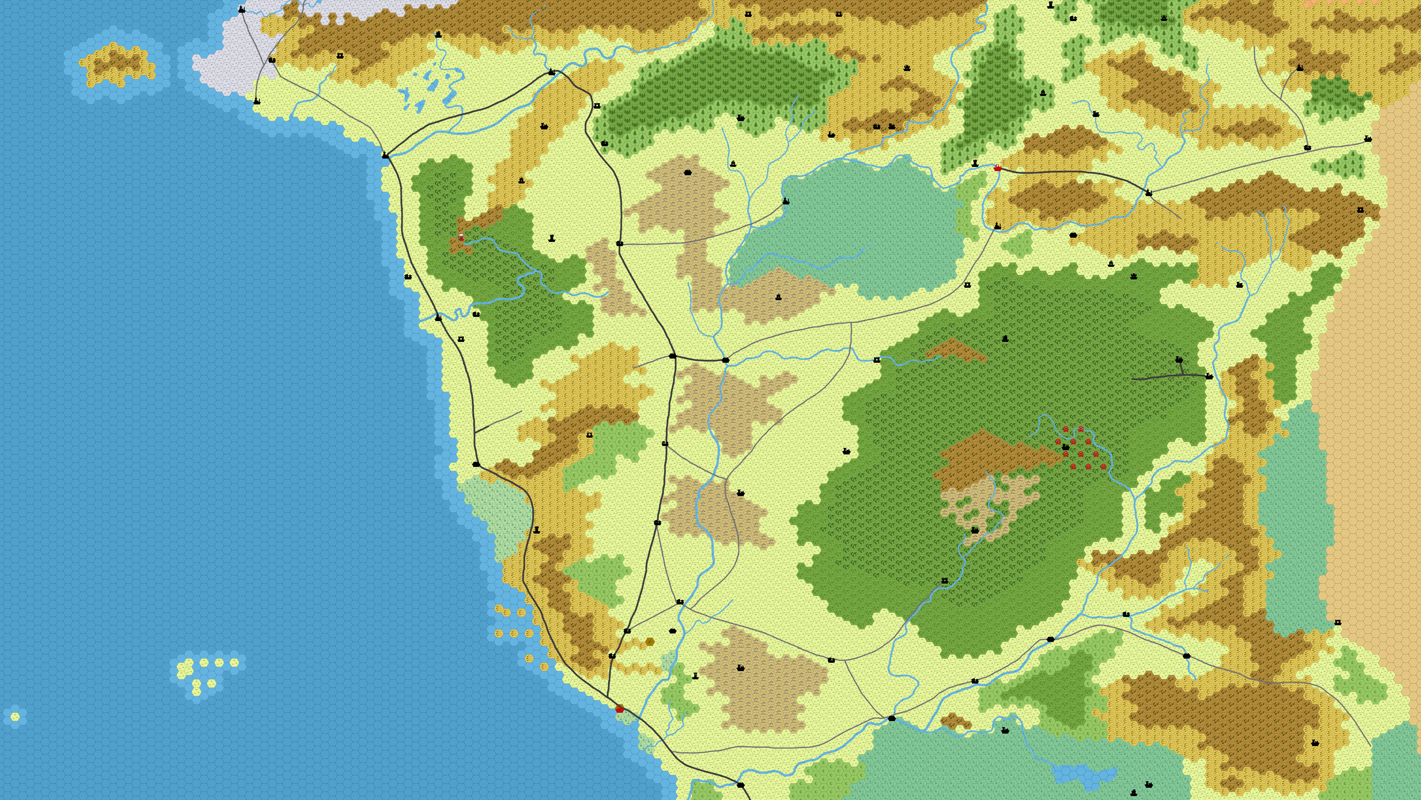
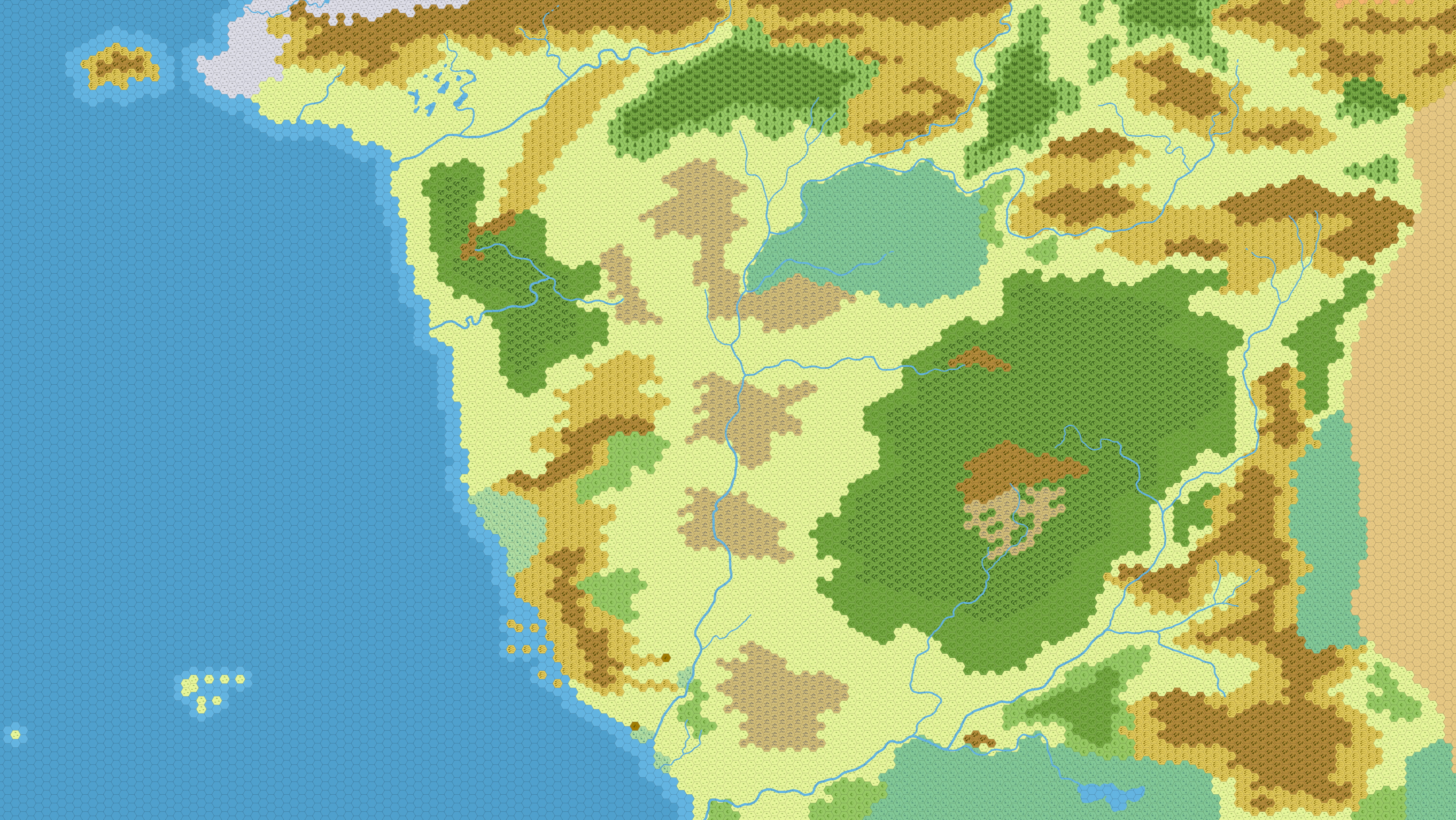
To get a familiar reference of scale for my own maps, I created this Hex map of the Savage Frontier region of the Forgotten Realms.
 If you’re interested in it, you can get it at full size here.
A version without any map icons can be found here.
Yora's site for Sword & Sorcery RPGs
You don’t happen to have the original hexographer file for this map do you? I’d love to get a copy if you do.
Thanks,
Todd
I did not make the map in hexographer but used GIMP with the HexGIMP plugin. I do have the original .xcf-file, if that would be of any use for you.
It would, if you don’t mind sharing it. Amazing job done in Gimp! I’m very impressed. I’m not sure if you can see my email address, let me know if you need it.
Thank you,
Todd
Sorry. I checked but the file is way too big for email. But I could make you a .png-copy of only the layer with the hexes, without the map icons and roads, if you’re interested in that.
This map looks lovely. Is it still possible to get this .png file?
There’s a link below the picture. Here it is again.
I’m sorry, I wasn’t clear — I was referring to the “.png-copy of only the layer with the hexes, without the map icons and roads” version.
I checked, and I still have it. There’s some difficulties with uploading the file right now, but there should be a link to it in the post some point later today.
Got it — thank you very much!
I gotcha, thanks. Would it be possible for you to publish the map the hex numbers? That would be awesome!
Thanks,
Todd
I tried, but numbering doesn’t seem to work in HexGIMP.
If you know how to use hexographer, there should probably be an option to import an image as a background over which you can draw the hexes. (There is.) Just change this map to black and white, and it should be relatively easy to recreate it as a true hexographer file with all the options.
Really like the map -but what scale are the hexes? Are they 5, 10, or 20 miles across?
That is indeed a good question. I am almost certain it’s 6-mile-hexes. I only use 6-mile and 30-mile scale, and this one is much too detailed for 30-mile (or even 24-mile).
Thanks! so many of the FR maps contradict each other -to the point that the newer ones delete the Westwood & the mountain range behind it and then move the Mere of dead men up to 50 miles north, so they are on the wrong side of the Sword mountains.
Now that you mention it, I do remember that I had been using multiple maps as reference and in the end had to pick my own scale that is kind of a middle ground between the various slightly contradictory maps.
Just dropping in to say that this map is remarkably well done. The accuracy of this map is uncanny, easily matching 1 for 1 with the official maps found in my adventure books. This makes for the perfect map for my players to use on their journey.
Thanks so much.
I made it in GIMP using transparent layers over an image of the original map. It’s as close as it can possibly get at this hex scale.
Great job! Congratulations! What is the measure of the hex grid in pixel? To make it easy to configure in vtts.
Thank you!
Each hex is 6 miles across. Figuring out how many pixels are in a hex would take me the same work as it would you. Just open the image in an image editor, zoom in, and count
;)
No problem, I didn’t expect you count for me, but you might already know the value if it were part of the setup when creating the map. It would be safer to have the exact value of the creator than me to count. Thanks o/