Return of the Mapper for online games?

Have you heard the good message of our savior Gus L? I learned entirely by accident that he didn’t stop writing RPG stuff but instead has been sharing new stuff on his new site All Dead Generations for the past three years. All the stuff on the site is about what he calls Classic Dungeon Crawling, which is basically OD&D and early Basic D&D, and how that style of Dungeon Crawling is an exploration fantasy game and not a combat fantasy game. A fantastic resource that I recommend to everyone, though it comes in hefty chunks that take quite a while to chew on.

After my overall pretty great D&D 5th edition campaign last year, I was throwing the towel on trying to make dungeons work, because I just could not figure out how to make a dungeon an interesting place that is not simply a warehouse for nonsensical puzzles. All the advice I was coming across on that front was “Well, sometimes funhouse dungeons can be fun.”But now, after 20 years as a GM, I finally get dungeons!

I have seen the light!

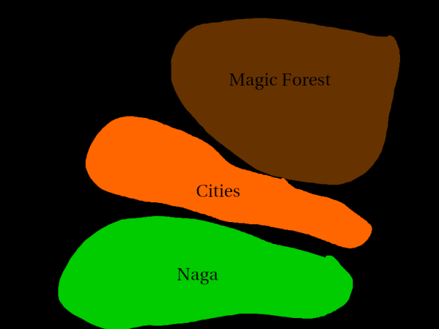
Dungeon Crawling and exploration in general isn’t just an aspect of an RPG, it’s even more a system of multiple mechanics than I previously had realized. Treating the whole dungeon as one big puzzle that will reveal the safest ways to the best treasures when figured is a great focus draw players engagement with the campaign. Especially when there’s no plot and characters don’t get shiny new toys every time they level up.

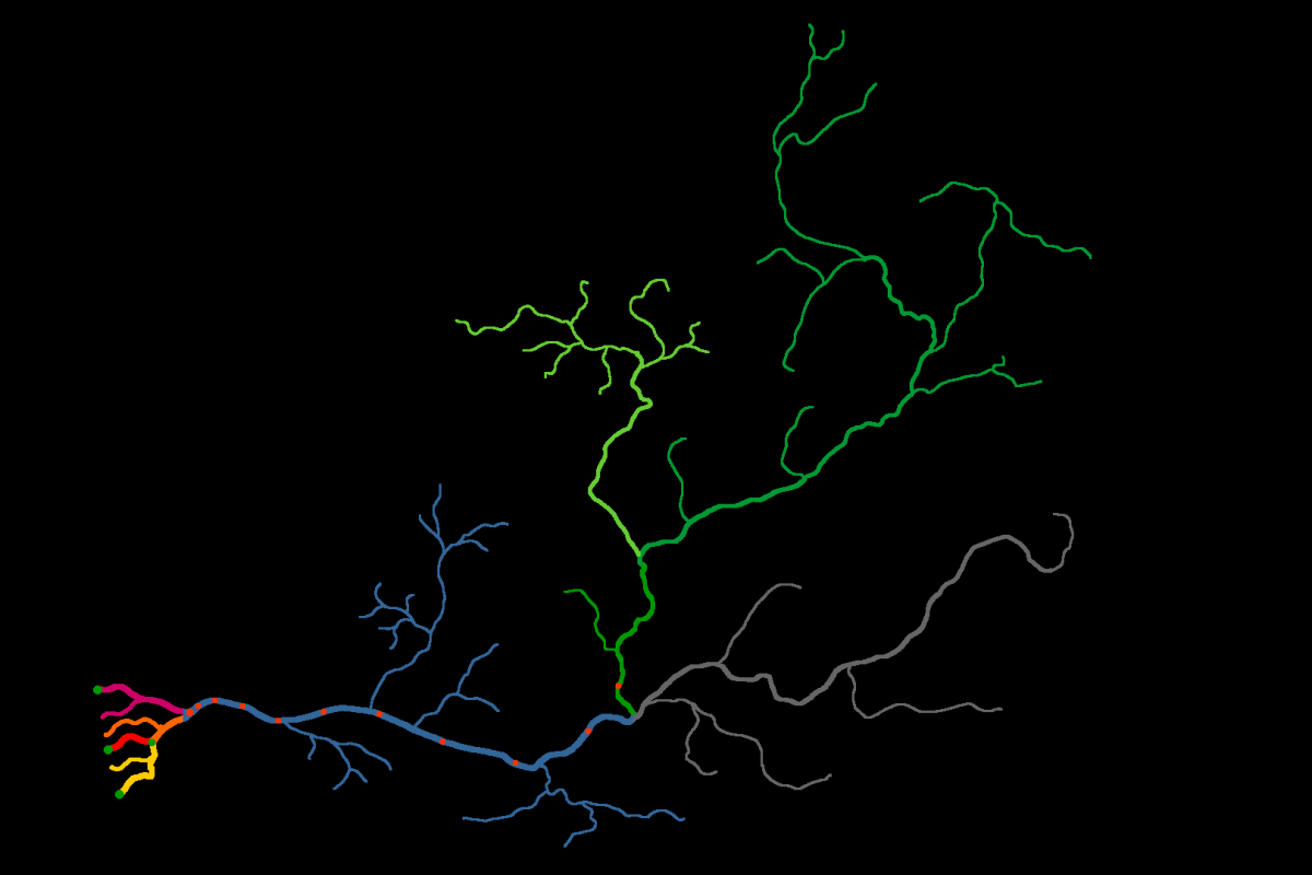
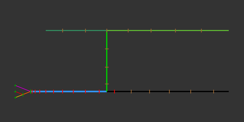
Part of solving that puzzle often is to fully grasp the layout of the dungeon and gain the ability to pinpoint the likely locations of possible shortcuts or otherwise completely inaccessible areas. Gus mentions that having players draw the map themselves is particularly bothersome in online games, where the GM can’t peak at a player’s pencil drawn map to spot obvious misunderstandings of his descriptions. (Minor errors in dimensions are desirable though.) But I took a quick look at Roll20 and found that at least in this case, this thing is actually very easy to do.

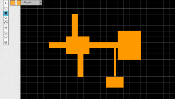
Roll20 has the paintbrush tool, which also has a shapes tool that draws rectangles by simply clicking and dragging. As a lifelong diehard user of pencils and grid paper, I think this is actually a lot easier and quicker than drawing lines around squares with a pencil. To correct errors, you can just click on one of these shapes and delete it, without any messing around with erasers. Now I’m definitely going to bring back this aspect of the game in my Great River Campaign. At least giving it a trial run. I’ve been told that there isn’t a function like this in Fantasy Grounds, but I’ve never used that myself. Which seems like a shame, since this is something really simple and basic. Though I guess when you do your mapping like this, you might not be bothering with something as fancy as Fantasy Grounds.

The Great River, v0.2

Click to embiggen

This is literally the same river as in my previous diagram, but now made to look like an actual river. It’s composed of maps of actual rivers at different scales, some rotated or mirrored. Green dots are cities, orange dots are trade posts.

Once I overlayed a hex grid in GIMP and set it to correspond to 100 miles for the river delta, I was able to count the actual distances, and it turned out that just by eyeballing, I got amazingly close to the numbers I had drawn up with no references yesterday. The Black River and Western Green River are 200 miles shorter than I had planned, but the length of Eastern Green River and the junctions of the main branches are all only 10 miles off from what I wanted. For reference, the Black River and the Lower River are based on the Mississippi at half-length, so it’s still a really big river.

I’m not quite happy with many of the side branches and will probably bend the Black River more south to make room for a big mountain range between it and the Green River, and maybe turn the Western Green River more southwest, but other than that I am really happy with this for a first attempt.

Mapping a River for pointcrawling

While tinkering further on my Rivercrawl idea, I cam up with this notation to map a huge river network.

First I made a Melan diagram of the main river branches for my river and marked the branches in different colors, which then looks like this.

I then turned the same information into a big table. Below you have a heavily cropped down version to show the principle of how it works. The real thing I made actually has 180 rows over five pages, but most are still completely empty at this point. The principle is basically the same as in Ultraviolet Grasslands, but without the illustrations. I find this easier for river that curves and fans out, compared to the more or less straight trade routes in UVG, and it also allows to make more notes without making a huge unreadable mess. As a tool for GMs to use at the table, I think this plain look isn’t a bad thing.

Getting the whole thing set up was a bit tricky, so here’s how I did it: Since I have only three main branches at any given point of the river, I made a table with seven columns. I think you could also do it with four branches and fit nine columns on one page, but more than that probably makes the thing more a nuisance to read than a help. I found that my river has seven different combinations of parallel running branches, so I made the table with seven rows as well. At this point you first set the column widths that you want, because this will be a total bitch if you try adjusting those later. After that you merge cells together as the river branches fork and meet, which in my case looked like this.

At this point, you can simple select and row and use “add rows below” or whatever your program calls it, and you should get an identical row to the one that you had selected. Then add mile markers to the leftmost row, and you’re done.

Now to the new neat feature that I actually came up with myself. The River Ratings. Each river section row has a little field on the left side that quickly shows the GM the water conditions the players are moving into. It’s fairly self-explaining when you look at the legend above. The letter says what size categories of ships can enter that section of the river. In case of my emerging setting, it’s galley size, junk size, dhow size, and canoe size. Ships larger than that will get stuck on the bottom of the river. (The width of the river or any obstacles in the water are not considered as a separate factor for the sake of convenience. Either your ship can continue on, or it gets stuck on something.) The number indicates the speed of the current. This number is added to your ship’s speed when you travel downriver, and subtracted when you travel upriver. If the speed of the current reduces your speed below 1 mile per hour, you can’t continue by water. I had been thinking to mark the type of terrain on the riverbanks as well to calculate overland speed, but that would mess the readability of this format with too much clutter. For the setting I want to make, it’s going to be “dense forest” pretty much everywhere anyway. I did a bit of looking around for average speeds of the boat types I listed, and the numbers I went with seem to be quite realistic. They are actually leaning to the lower end, as I suspect the original numbers were based on strong ocean breezes, so it would be slower further inland.

My plan for the campaign is that there is an adventuring season of 8 month, which is then interrupted by a flood season of 4 month, where the water speed is simply too much along the whole river to get upstream. I think it would be cool to make a roll at the start of each new adventuring season to see if water levels are exceptionally high or low this year. A high river increases the size rating for the whole river by one, while a year of low water levels reduces it by one. The players might find that the expedition they had planned either needs to be canceled or attempted with a much smaller boat as the river conditions make reaching the destination in a junk or dhow impossible. You could also have a randomly determined special event that changes the water level or speed halfway through the season, which can lead to very inconvenient complications hundreds of miles away from civilization.

This was a mistake

If you can’t be a good example, you can at least be a cautious warning.

I’ve been thinking about how I can get myself into thinking of Planet Kaendor as a wilderness setting instead of always ending up putting all my efforts into the city states, which are supposed to be exceptional special cases in the setting and not the site of much adventure.

And in the process, I realized that the whole geographical layout that I cobbled together years ago is actually really bad.

The idea for the setting is that there are a few small clusters of civilization on the coast of the mainland, beyond of which lies a vast expanse of strange and wondrous forests. And the one thing the setting has in the way of major bad guys are the naga, who used to control much of the world in the ancient past, but are now driven back into the southern jungles where they plot their return.

Breaking down the layout for the overall geography like this immediately show the problem. The big weird forest and the naga jungles are in opposite directions? Delving deeper into the wilderness does not bring the party in closer contact with the naga, it takes them further away from them. And it doesn’t make sense for the naga to do some plotting and scheming in old ruins in the great forests because they would first have to get through the cities to get there.

I think all the way back when I came up with the general map layout, I didn’t really had much thought put into the naga yet, and only decided that I want to have them somewhere. But with the ways the ideas have morphed in the years since then, it has become increasingly impractical for the new concept.

Can’t see the forest for the trees

Given how many fantasy worlds are dominated by uninhabited wilderness, and how much the generic image of fantasy is based around forests, it’s pretty surprising to see how little ink has actually been spilled on this aspect of fantasy worlds. If you look around the internet for information about forests in RPGs, there’s basically nothing. All that I could find is how to draw forests on a map. There’s a bit more stuff on the topic of wilderness in RPGs, but most of it comes down to “how do I make overland travel less boring?” There seems to be almost nothing in regards to exploring forests as a setting in itself. About how the environment can be a driving force in the narrative of the campaign and how it can communicate tone and themes. Forest is just there, as an amorphous blank space.

So much potential for adventures? Don’t you feel inspired yet?

Interestingly, it seems that deserts have been explored much more over the decades, both in RPGs and fantastic literature. Deserts pose a clear immediate danger, in the lack of water and shelter from the sun. It’s also immediately obvious that you can’t just have a full campaign set in nothing but sand dunes. You also need rocky deserts, barren hills and mountains, and various oases, and you can occasionally break things up a little with a big sandstorm. For forests, we don’t really have such palette of different shades. On maps, you might get “light forest” and “heavy forest”, or possibly “forest” and “jungle” as two different shades of green, but at the end of the day, forests end up being big green blobs on the map, with about as much variation as the ocean surface.

In Veins of the Earth, a book about entire campaigns set in caves, there is an appendix about “Twelve Kinds of Dark”. Darkness is always a simple absence of light. In the physical reality, all darkness is exactly the same thing. But narratively, and in the context of tone and atmosphere, darkness and shadows can have a wide range of different feels. The darkness of a basement in a ruined house is very different than the darkness in the corners of a jarl’s hall, that is illuminated only by a single fire as the skald is telling his tales of old heroes to his audience.

At the end of the day, every forest is an area covered in trees. But really, not all forests are the same. Far from it. Different forests have different visibility based on the density of tree trunks and the undergrowth. They have different amounts of light based on the canopies. Some forests have almost perfectly flat floors while others grow on extremely rugged and rocky terrain. Some forests seem almost bone dry for long parts of the year while others are flooded or a soggy mud everywhere you step. Forests can be home to large numbers of animals, while others seem almost empty. And some can be full of fruits while others are nothing but pines. And this hasn’t even touched on the subject of introducing specific tones and atmosphere.

With Planet Kaendor, I always had this idea of making it a forest world. But in practice most content I work on deal with coastal cities, while the tree covered interior remains that damned big green blob without distinguishing features. Four of my favorite evocative settings are Barsoom, Dark Sun, Dune, and Morrowind. All of which are essentially desert settings. But you can’t just take these places, cover them entirely in trees, and call it a day. In all of them, the deserts are an active character in the world. To make a setting a forest world, there first needs to be a deeper exploration of what a forest can actually be as an environment and how it can shape stories.

More on that hopefully soon.

How large does a setting have to be?

This is North-West-Cental Europe. It it an area exactly 1,000 miles from North to South, and 1,000 miles from East to West.

Think of what comes to your mind when you hear “The Middle Ages”. Unless you have a specific, personal interest in medieval Spain, Ireland, or Russia, almost everything that you think of will have been within this area, with the one notable exception of the Crusades. Even the vast majority of all Viking stuff.

Historians generally place the Middle Ages in roughly the time from 500 to 1,500 CE, which happens to coincide with the disappearance of the Roman Empire in Western Europe, and the discovery of America and the Reformation. So it all also falls into a span of 1,000 years.

A thousand miles and a thousand years. That’s the Middle Ages as a setting for popular fiction and reference frame for Fantasy. Compared to many popular fantasy settings, that’s tiny. But there’s so much stuff in this little box. More space than you could ever possibly need to tell your stories. It certainly won’t hurt if you can give names to the distant lands that lie beyond the edges of the map, where merchants get the most exotic of their goods. But to characters dealing with their own lives inside of this box, they don’t need to be anything more than that. Things are of course different for campaigns about traveling to far away exotic lands, which certainly have their place in fantasy. But those really are the exception, not the rule.